The 'Other' Rides... (The MadMap Rides)
Coors Ride - 12 Miles (Round Trip)
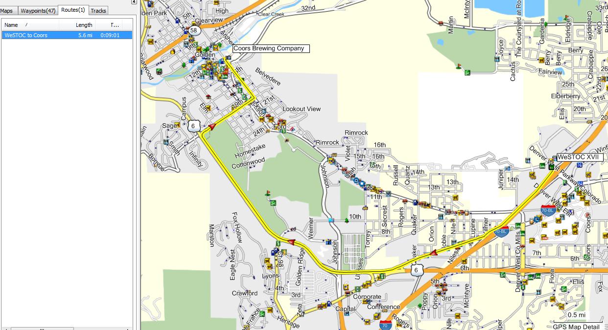
Tours run every 20 minutes. Open Monday through Saturday, 10 a.m. to 4 p.m., and closed Sundays and holidays. About six miles each way.
Red Rocks Ride - 15 Miles

Clearview - Pine Valley Ranch Ride - 90 Miles (Round Trip)
![]()
Additional Info: Take your camera! This ride takes you through Red Rocks Park, beautiful rock formations. If you have time have a coffee or latte in the Trading Post, and sit out on the deck. On the upper lot checkout the large visitors center, most interesting. Then takes you through Parmelee Gulch, nice twisties. Also takes you through Tiny Town. This is a town with a detailed miniature town and railroad, lots of Kodak moments. At Pine Junction you have a couple options, or do them both:
You can turn right a couple long blocks to Clearview Shields if you wanted to see any of their products.
Or turn left which takes you down 126 to Pine Valley Ranch. Great twisty road. This is a beautiful Park, free, along the South Platte River and a short walk to a scenic pond. Also has the nicest outhouses in Colorado...
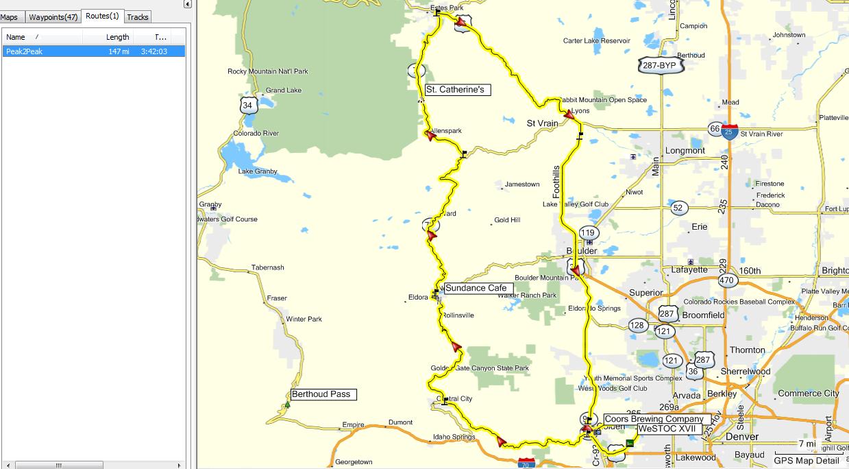
Peak to Peak (and more) - 144 Miles
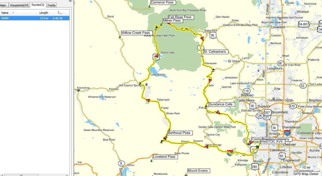
RMNP / Trail Ridge (and more) - 201 Miles
Fairplay Loop - 181 Miles

Golden Gate Canyon / Peak-to-Peak North Loop - 237 Miles

Mount Evans - 127 Miles

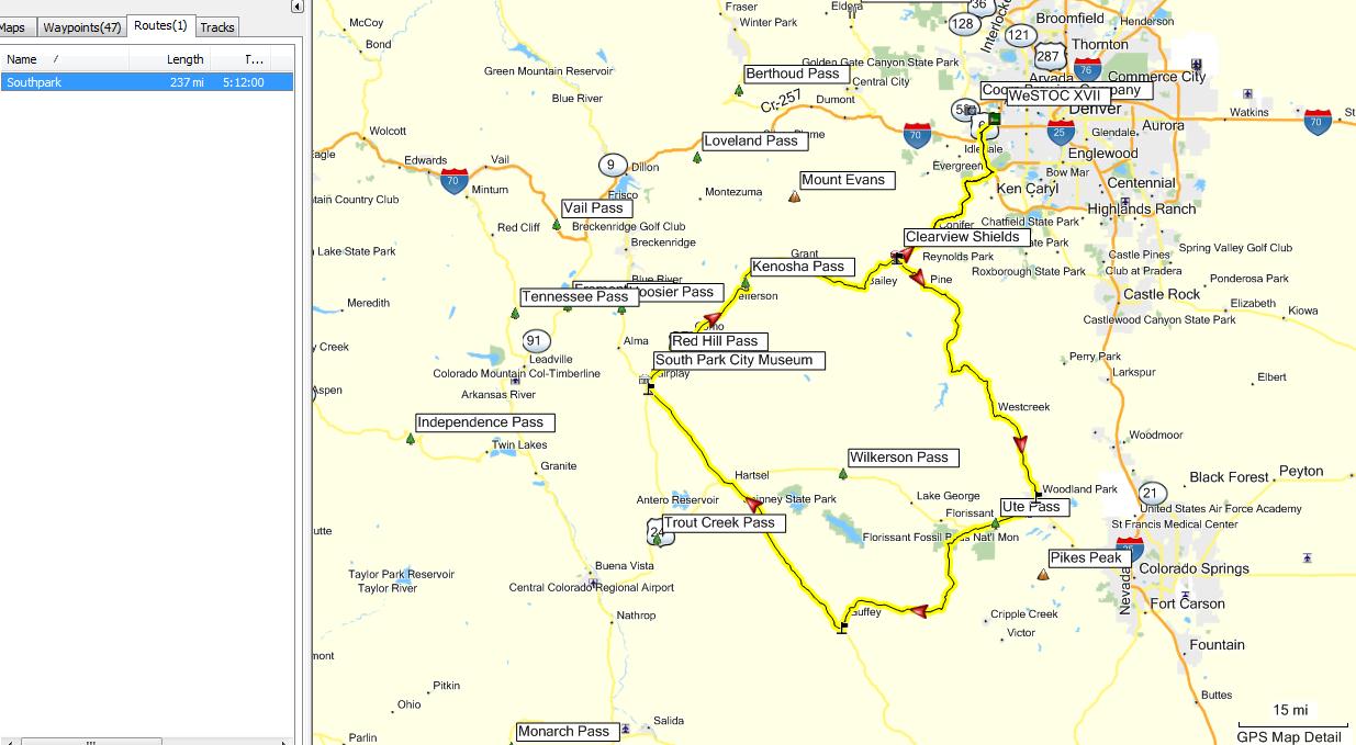
South Park (Pikes Peak area - 245 Miles
Single
Garmin .gbd file with all these rides - Version 1.2
Route Map
jpg Files - Version 1.2
NOTE!! The GPS routes available above were created using Garmin's Mapsource program and the City Navigator North America NT2013.10 map database. If you have an earlier version of City Navigator, or if you own a different gps, or use a different map set with your gps, you must verify these routes before using them!! Due to differences in the various map sets, you <may> get a slightly different route when using the provided routes!! To verify the route, load it into Mapsource, double click on the desired route in the route list, and select 'recalculate route'. Mapsource will then use the route waypoint data and your map database to create the route. <Sometimes> the route you get can vary from the desired route due to differences in the various map databases. Carefully compare the route you get with the routes above. If you do see a deviation from the desired route simply right click on the route and select 'insert route section', then pick a point on the desire road. Mapsource will modify the route to include that road section. You can then upload the route into your gps. The verification process is an important step if you are using any other mapset!. Even if you upload these routes into a different gps and they <look> correct, be wary! The first time the gps <thinks> you're off route it will perform a recalculation of the route and <may> change the route to <something> different!!